

english:glossary:digitization
Digitization
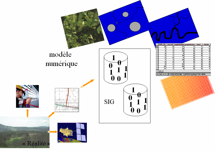
Geographic information that has been manipulated by geomatics is by nature in digital format. The word digitization on the most general level can be considered as a synonym for scanning, but in the most limited sense delimits entities in vector mode. The widespread nature of digital geographic data has contributed to bringing into dialogue the separate activities and disciplines that address space: cartography, technical drawing, topography, aerial photography, photogrammetry, and a convergence of different sectorial computer systems (CAD Systems, cartography, surveying, DBMS).
english/glossary/digitization.txt · Dernière modification : //26/08/2018 11:11// de joliveau