

english:glossary:dtm
Digital Terrain Model (DTM)
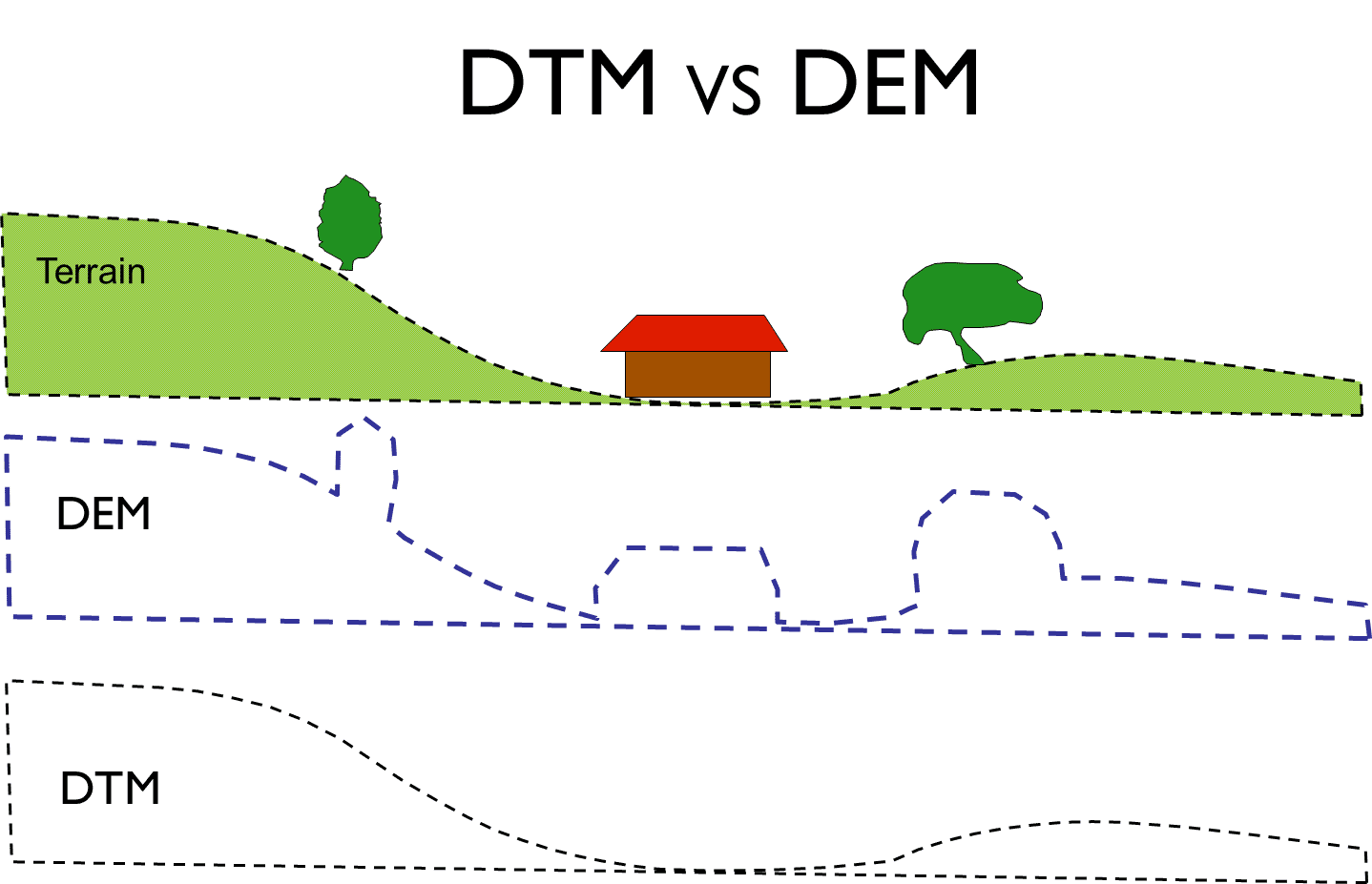
This is a digital representation of relief and thus the elevation values of a given geographical area. One can derive an indication of the gradient and elevation values as well as the forms of the topographic surface of this area. If it only represents the height of bare soil, it is called DTM. It takes into account the heights of all objects placed on it such as buildings and vegetation, it is called Digital Elevation Model (DEM).
A DTM may take the form of vector files (points, polylines where each entity has height information), a raster file (where each pixel or cell has height information), or Triangulated Irregular Network (TIN model).
english/glossary/dtm.txt · Dernière modification : //26/08/2018 11:07// de joliveau