

Geographic Information
Geographic information, as the name suggests, is a specific type of information integrating localization properties of the earth’s surface. It has three components: spatial, temporal and thematic, as illustrated by J. Dangermond’s cube:
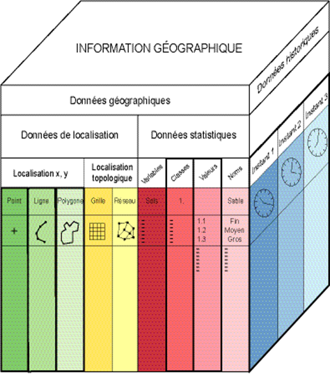
The cube of geographic information (Dangermond 1983)
These three components can answer various questions by interrogating the geographic database using spatial and attribute queries. The spatial component: what do we find here? Where is this type of entity? Is this entity similar to its neighbors? The temporal component: when was this? Which entities appeared after this date? The thematic component: what is this? Is this different from that? The power of a GIS comes from its ability to answer questions combining these three components. Example: what is the nature of the objects that appeared during this last decade near this other object?
See: Information Systems, Entity
[French: Information géographique]