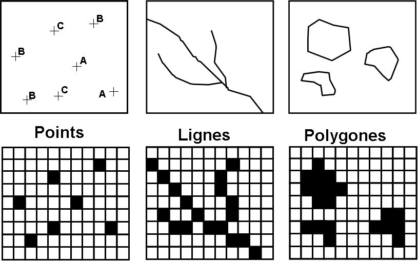
Raster (Mode)
The raster mode represents space on a regular mesh applied to the earth’s surface. This mesh is in the form of a grid with cells of a predetermined size that are assigned specific values. The size of the cell is called spatial resolution. Raster mode corresponds to a view of the world where phenomena varies continuously as fields in the physical sense, like a magnetic field, for example. The raster grid can then be seen as a sampling of this continuous field where each pixel is an element of a sample of the reality studied. It conceptually opposes the vector method, which is based on a division of the a priori world into distinct entities, performed in a discrete space (in the mathematical sense) where each polygon is a component of a sample of the reality studied.
Each cell is assigned a value that matches a measure (of pollution, altitude), a category (vegetation type), the identifier of an object (a municipality code, the number of a highway route or a school), a color code from the scan of a topographical map, or a value measured by a sensor on a satellite. In raster mode, a real world object is not explicitly described, and exists only as a grid of cells in the system. To find an object, one asks the system to display all the cells carrying the code for this object.
Raster mode is used often in the field of remote sensing to store images that are taken of the Earth’s surface. The grid takes the name of the image and the cells are called pixels. Satellite images combine multiple channels of different radiometry measures that must be combined with colorful compositions.