Vector (Mode)
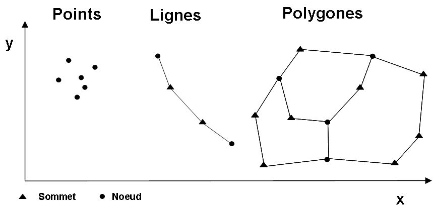
Vector mode corresponds to a discrete view of the world, constituted of distinct entities, unlike the raster mode that corresponds to a continuous model. In vector mode, real-world entities are translated using geometric forms to express their contours. There are three basic shapes: points, lines and polygons. These shapes can be translated numerically through coordinate pairs (x, y) or triplets (x, y, z) in 3D GIS. Vector structures may be more or less complex. If the geometric relationships of contiguity and connection are not taken into account, it is called a spaghetti model. In the simplest model, points are stored geographically as coordinate pairs, lines as sets of coordinate pairs, and polygons as sets of coordinate pairs in which the last is identical to the first (closing the contour). The topological model can take into account the fact that two adjacent polygons share a line and two lines intersect at a point which is common to them. One way to construct a topological vector model is to consider the points as basic elements, the lines as connections between these points and the polygons as the layout of lines connecting together. In a vector data structure, we must distinguish between nodes that establish connections between objects and the summits that build their form.