english:glossary:spatialjoin
Spatial Join
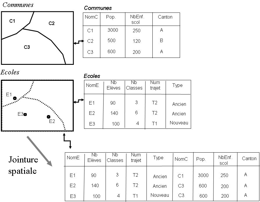
The spatial joit uses the same principle that applies to the joint attribute, but instead joining two tables based on a logical relationship (sharing the same field), it is a spatial relationship that matters, i.e. a positioning feature shared by two entities. For example, a table of schools may be joined to a table of municipalities based on a spatial relationship of geometric inclusion. If the school's point is within the polygon corresponding to the municipality, the attributes of the municipality table become attributes of the school table. By definition, a joint can only be performed between geographic data and not between two attribute tables.

See Database, Join (Based on Attribute)
english/glossary/spatialjoin.txt · Dernière modification : //01/06/2015 22:07// de joliveau

