

english:glossary:dataorganization
Data Organization
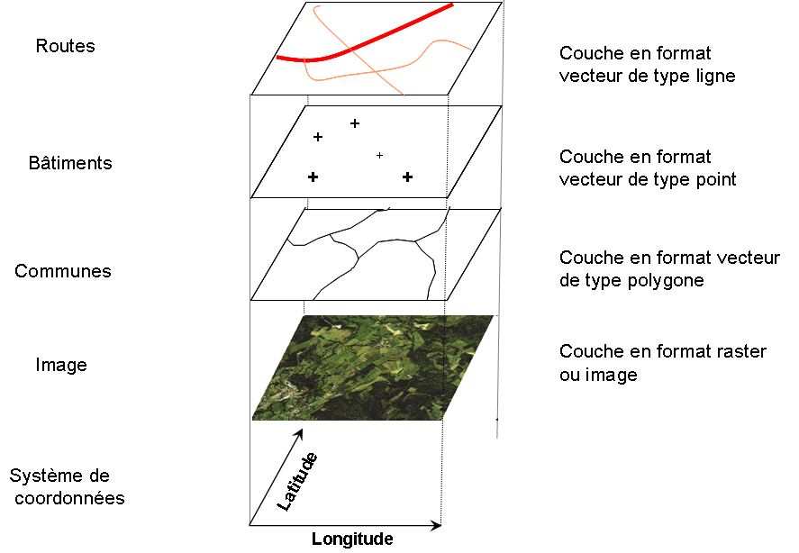
The oldest and most common structure of a geographic database takes the form of layers of information, thematically homogeneous, superimposed and locked on the same geographical space. These layers can be in raster or vector format with associated attribute data in tables. There are several implementations. The oldest and most common is in the form of separate files organized in folders. More and more often the geographical data, spatial as well as attributary, are stored in Spatial Database Management Systems (SDBMS).
See: Database, Spatial Database Management Systems (SDBMS)
[French: Organisation des données]
english/glossary/dataorganization.txt · Dernière modification : //26/08/2018 11:03// de joliveau